|
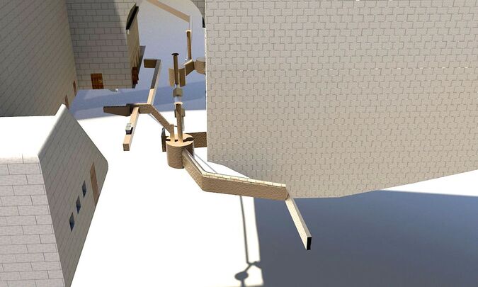
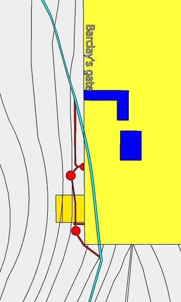
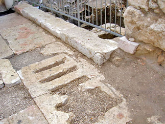
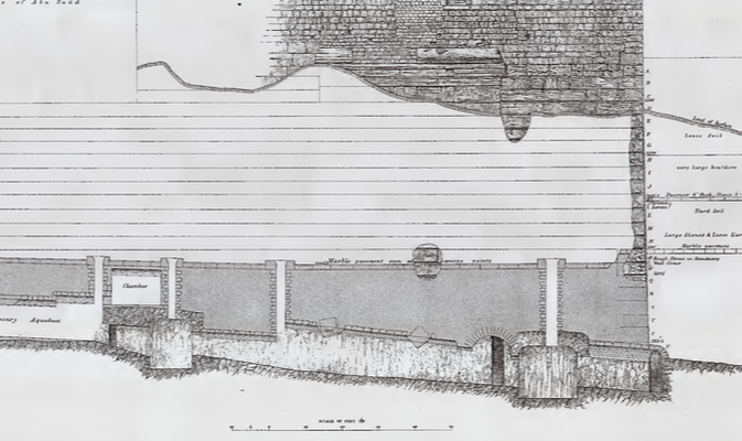
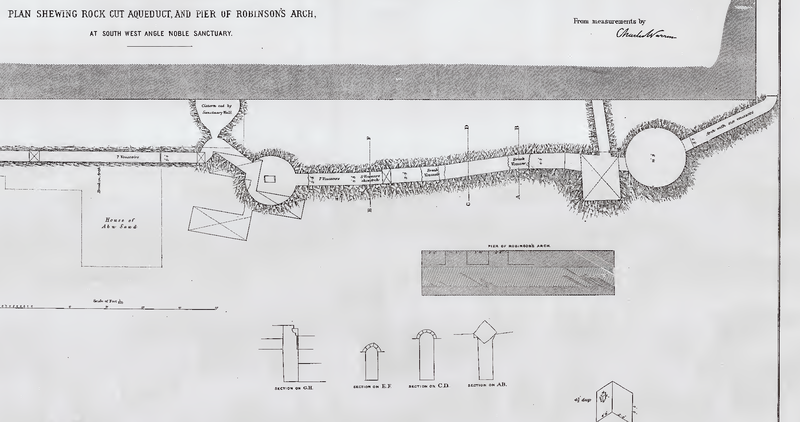
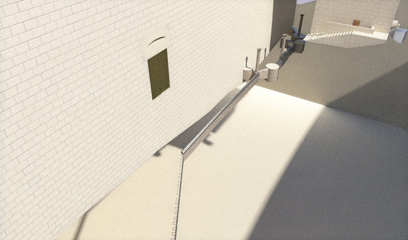
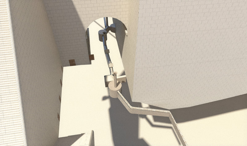
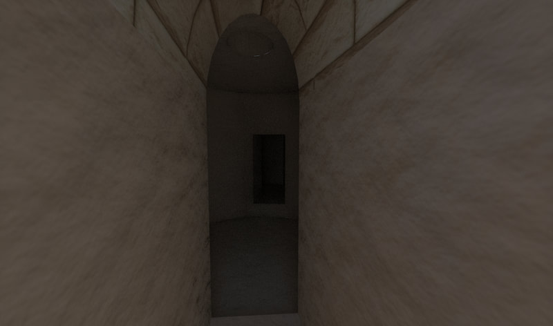
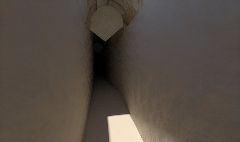
Running under the main street of Yerushalayim was a large drainage channel, partly cut into the rock. This channel went from the north of the city to the south, passing on the west of the Shiloach pool and exiting the city there. This drain was originally built at some point before Hurdus's time and was roofed with flat stone slabs. When Hurdus expanded the Har Habayis, the walls cut this drain, so a "by-pass” (with a vaulted roof) was made to connect the two severed sections of the drain. This "bypass" cut through several underground caves and cisterns in the area. A network of channels brought the water from the street and nearby buildings to this drainage channel. One paving stone by the western curb of the street, (right by the southwest corner of Har Habayis,) has five slots in it, for the water to go down to these channels, and from there to the main drainage channel. When the Romans destroyed Yerushalayim, some Yidden tried hiding in this drainage channel, but the romans searched for them and found them, and killed them. (Josephus, Wars 6:9:4 [6:429]). Under the middle of Robinson's arch, this channel is 12 ft (3.6 m) deep and 4 ft (1.2 m) wide; and its eastern side is 12 ft (3.6 m) from the Har Habayis wall at this point. The bottom is at a level 2,313 ft (705 m) above sea level. The channel slopes down towards the south. As mentioned, this part has a vaulted roof, but opposite the center of the pier this roof has been broken in for about 20 ft (6 m) in length by two large stones, apparently the voussoirs of an arch, which have fallen from above. One of them is much decayed; the other is 7 ft (2.1 m) long, between 4 ft 4 in-5 ft (1.3-1.5 m) thick, and 4 ft (1.2 m) high. Towards the center, at one side, is a square hole 14 in by 11 in (35 by 27 cm), and 4 in (10 cm) deep. The vaulted roof was built up against and slightly over the arch stones. These fallen stones are generally explained by saying that the "bypass" was made at the same time as the construction of Robinson's arch, and these two stones fell down from the arch during its construction. Ronny Reich suggests that this collapse happened because the builders attempted to build the arch with a new method they didn't really know (supporting it during construction with a wooden scaffolding supported on the dentils.) After this collapse, they then rebuilt the arch using the method they were familiar with (supporting it with large earthen mound). At 24 ft (7.4 m) south of the two voussoirs is a square rock-cut cistern, covered with an arch, from which a passage runs east towards the Har Habayis wall, which cuts it into two. This passage actually leads to a room with a Mikveh. The Mikveh is next to the opening of the passage, negating it; and therefore, it postdated the opening. Remains of two rock-cut steps in the original entrance to the mikveh from the east are preserved. The upper edge of the Mikveh is visible; it has rounded corners and is coated with gray plaster. The ceiling of the Mikveh is a stone-built vault. It appears that this square room and the Mikveh room are part of a basement of one of the houses located here, that were destroyed by Hurdus's expansion of the Har Habayis. Directly to the south of this square room there is an entrance to a circular rock-cut cistern, which has a diameter of 16 ft (4.8 m), and a height of 14 ft 4 in (4.3 m). The roof of this cistern is of rock, and flat, with a thickness of 2 to 3 ft (0.6 to 0.9 m). The roof is pierced with a shaft leading down from above. The entire cistern is coated with well-preserved, yellowish-brown plaster. The drainage channel continues from this cistern to the south with its bottom nearly at the same level as its level in the north, while the bottom of the cistern is 3 ft (0.9 m) lower. The channel continues to the south-east, here it is 8 ft (2.4 m) deep, 3 ft 9 in (1.1 m) wide, and covered by a slightly pointed arch of six stones. After passing the south-west corner of the Har Habayis, the channel turns towards the east, and, emerging from the rock, is carried on in masonry, having now a width of 3 ft (0.9 m), and covered by an arch of 5 voussoirs. It slopes rapidly towards the bed of the valley. After about 40 ft (12 m) it turns to south, and meets up with the old drainage channel, which is 2 ft (0.6 m) wide. To the north of the fallen stones the channel runs slightly away from the Har Habayis wall, and is 3 ft 9 in (1.1 m) wide and about 11 ft (3.3 m) high. It is roofed by an arch, with five courses, two on one side, measuring 22 in (0.5 m), and three on the other side, measuring 33 in (0.8 m). At 34 ft (10.3 m) from the north end of the pier the channel cuts into a circular rock-cut cistern, which is 12 ft 9 in (3. 8 m) in diameter, and14 ft (4.2 m) high, with its floor 3 ft (0.9 m) below that of the channel. Its roof is of rock which is pierced with a shaft from above. There are also two shafts down to the actual channel, between the two rock-cut cisterns, but only one is shown in Warren's plan. A canal 4 ft (1.2 m) wide, cut in the rock, and 14 ft (4.2 m) in length, enters this cistern at the north. At the north end of this canal, to the east, is the entrance to a circular rock-cut cistern, of which only half can be seen, as it is cut in two by the foundation of the Har Habayis wall. The canal from this cistern turns to the west for a few feet, and then sharply to the north: it leaves the rock and is continued in masonry for 123 feet (37.4 m). Over here, it is 3 feet (0.9 m) wide and 8 feet (2.4 m) high, with an arch made of five voussoirs. In front of Barclay's Gate, and at about 14 ft (4.2 m) from the Har Habayis wall, it meets the old channel, which over here is 18 in (45 cm) wide. It now turns away from the Har Habayis wall, and more or less follows the Tyropoeon valley line. Opposite Barclay's Gate the bottom of this channel is about 7 ft (2.1 m) above the rock. The Channel, from its start to the southwest corner of the Har Habayis, has a fall of about 1:20. reference
מזר, בנימין, and B. Mazar. “The Excavations in the Old City of Jerusalem Near the Temple Mount — Second Preliminary Report, 1969—70 Seasons / החפירות הארכיאולוגיות ליד הר-הבית: סקירה שנייה, עונות תשכ"ט—תש"ל.” Eretz-Israel: Archaeological, Historical and Geographical Studies / ארץ-ישראל: מחקרים בידיעת הארץ ועתיקותיה י (1971): 1–34. http://www.jstor.org/stable/23619371. Conder, Claude Reignier, and Warren, Charles. The Survey of Western Palestine: Jerusalem. London, 1884. רייך, רוני, and Ronny Reich. “The Construction and Destruction of Robinson’s Arch / בניינה וחורבנה של קשת רובינסון בהר הבית שבירושלים.” Eretz-Israel: Archaeological, Historical and Geographical Studies / ארץ-ישראל: מחקרים בידיעת הארץ ועתיקותיה לא (2015): 398–407. http://www.jstor.org/stable/2443307 9. Shukron, Eli, and Ronny Reich. “Jerusalem, Robinson’s Arch: Preliminary Report.” Hadashot Arkheologiyot: Excavations and Surveys in Israel / חדשות ארכיאולוגיות: חפירות וסקרים בישראל 123 (2011). Ritmeyer, Leen. The Quest: Revealing the Temple Mount in Jerusalem. Israel: Carta, 2006. Tunnel-vision politics in Jerusalem – Ritmeyer Archaeological Design Tunnel-vision politics in Jerusalem (cont.) – Ritmeyer Archaeological Design Warren, C. (1884). Plans, Elevations, Sections, &c. Shewing the Results of the Excavations at Jerusalem, 1867-70. (London) ["Know as Warren's atlas"]
0 Comments
Leave a Reply. |
Website updatesI have added a new lego model of the Third Beis Hamikdash, with pictures and a video in the lego gallery. Categories
All
Archives
February 2024
AuthorMy name is Mendel Lewis. Hashem said to Yechezkel, "Its reading in the Torah is as great as its building. Go and say it to them, and they will occupy themselves to read the form of it in the Torah. And in reward for its reading, that they occupy themselves to read about it, I count it for them as if they were occupied with the building of it. (Tanchuma tzav 14) |
- Beis Hamikdash posts
-
sources
- Mishnayos Middos >
- Gemarah
- Rambam >
- Rishonim
- Sha'alos Uteshuvos HaRaDVaZ
- Shiltey Hagibborim
- Ma'aseh Choshev
- Chanukas Habayis (both) and biur Maharam Kazis on middos
- diagrams >
- Tavnis Heichal
- Be'er Hagolah
- Binyan Ariel
- Shevet Yehudah
- other
- Braisa D'Meleches Hamishkan
- Third Beis Hamikdash sefarim
- from Josephus-יוסיפון >
- קובץ מעלין בקדש
- Kuntres Klei Hamikdash
- Gallery
- videos
- 1st Beis Hamikdash
- 3rd Beis Hamikdash
- virtual walkthroughs
- 3d models
- Lego Gallery
- diagram of Mizbeach
- contact
Proudly powered by Weebly

 RSS Feed