|
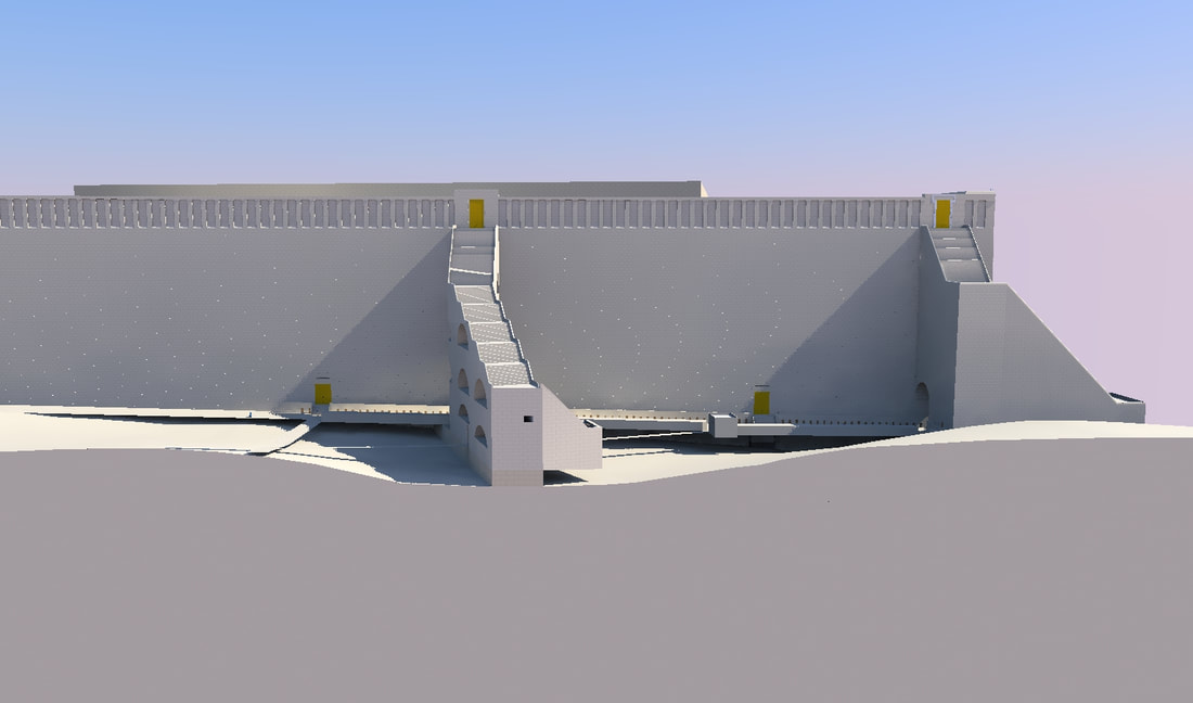
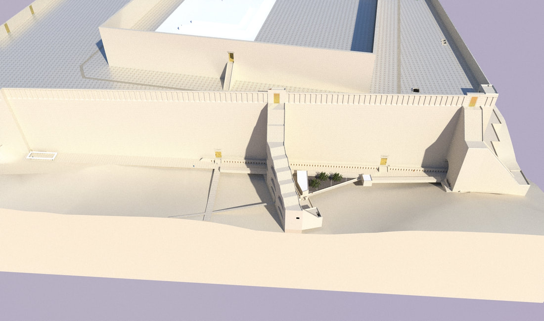
The western wall of Hurdus's expansion of Har Habayis, is 485 meters long. This wall, as mentioned in an earlier post, is not perfectly aligned with the north-south-east-west axis, rather it is on a ten-degree angle from it. It had four gates (Josephus, antiquities 15:11:5), two of which led through tunnels to the top of Har Habayis, and the other two opened on top, straight into the plaza of Har Habayis. The northern lower gate is now called Warren's gate, and the southern one is called Barclay's gate. The two upper ones were on top of what is now called Wilson's arch and Robinson's arch. I will IMY"H discuss these gates in future posts. The whole western wall that we see is from the time of Hurdus. (See this post for more details about the date of the construction of this wall.) As part of Hurdus's project to rebuild the Har Habayis, he made new roads and plazas on the southern and western sides. This construction work continued for decades, for although the actual Beis Hamikdash was completed in three years (Bava Basrah 4a), and the Har Habayis in eight (Antiquities 15:11:6), the work continued until the time of Agrippas the second, in the year 64, or 3824, eighty years after this project was started (Antiquities 20:9:7). Under the main street, next to the southwest corner of the Har Habayis, coins were found from the time of the roman governor Pontius Pilate, who was the governor of Judea from the years 26 to 36 (3786 to 3796), so this shows that the street was built after this time. Josephus, in fact, writes (Antiquities 20:9:7) that Agrippas II let the Yidden repave the streets of Yerushalayim, so some say that this pavement is from that time. However, being that the latest coin found under the street is from the year 30/31 (3790/3791), it seems that this street was made then, and by Agrippas's time, they only repaved it, but left the dirt supporting it in place.
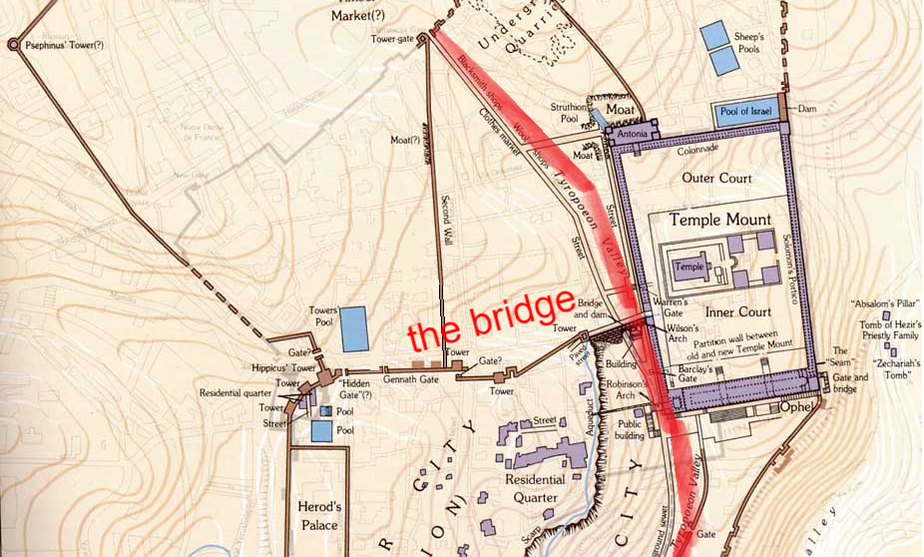
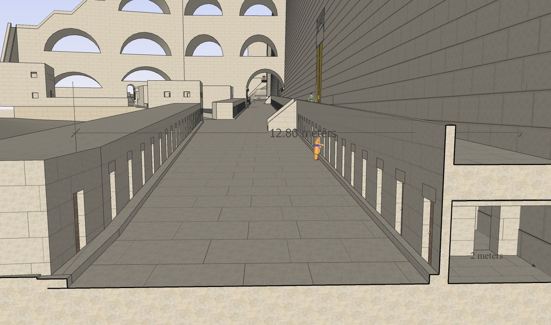
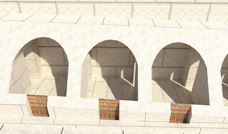
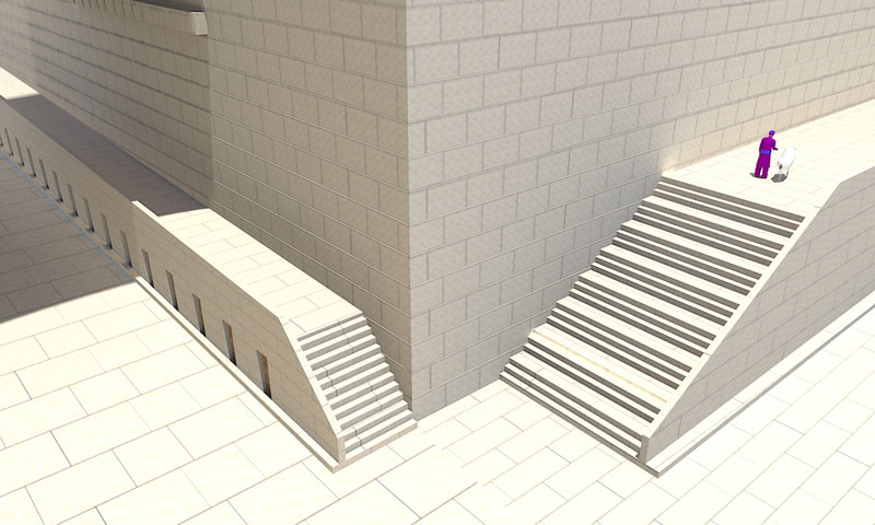
Running more or less along the line of this valley was the main road of Yerushalayim. It went up from the Shiloach pool for 600 meters to the south to the Har Habayis, and then went along the western wall until it stopped next to the northern corner. The part from the Shiloach to the Har Habayis was eight meters wide and had many steps to go up, which is why it is now called the stepped street. The part of this street running along the western wall was 12.80 meters wide, but the three meters (ten feet) right next to the wall had rooms built on them, so the street was only nine-ten meters wide. These rooms are approximately two meters wide, and have arched roofs, supporting the walkway that ran on top of them. The height of these rooms and their roof was around three meters. These rooms had doors to each other. There were also rooms on the other side of the street. Since in the rooms under the pier of Robinson's arch, many stone weights and coins were found, it seems that all these rooms were stores. This would have made this road the main market of Yerushalayim, were people could buy anything they need. Running along both sides of the street, in front of the stores, was a curb, to help prevent water from running into the stores. The paving stones of this street are big, being up to four feet (1.22 meters) long, and over a foot (0.31 meters) thick! Branching out from this main street were three other streets. The first one went up to the upper city of Yerushalayim, to the west of Har Habayis. This stepped street was right next to Robinson's arch. The next street branched off in front of Barclay's gate, and more or less followed the Tyropoeon valley line. It went out of the original city walls, into the area in the second wall. (The second wall was built by Hurdus to encompass the houses built outside the city, in the north.) The third street led to the west from Warren's gate, which was outside the first wall of Yerushalayim. (The first wall is the original wall of Yerushalayim, from before Hurdus's time.) Yosifun (in sefer Yosifun, chapter 55) mentions these streets. He says "and the road was in the valley, (this is the version in the Mantua edition,) from which went three streets. Two of them went to outside the city (outside the original walls), and one went down with steps to the valley (referring to the staircase on top of Robinson's arch, which led from the Har Habayis down to the valley), and from there it turned and went up to the city". [והדרך (בתווך) [בעמק (דפוס מנטובה, ובכת"י ירושלים איתא והעמק בתווך)] אשר בו דרכים שלשה. השנים מהם הולכים אל מחוץ לעיר והאחד הולך ויורד במעלות אל העמק ומשם סובב ועולה אל העיר] The road slopes up from south to north, following the rock level underneath, however the rock rises more sharply, starting in the south 21 feet (6.4 meter) under the road, and in the north, it rises higher than the street, and it had to be cut down to make the street. If you look closely at the bottom of the northern part of the western wall of Har Habayis, (in the Kosel tunnels,) you can see it is actually the bedrock, which was carved out to look like Herodian stones. reference
Ben-Dov, Meir. In the Shadow of the Temple: The Discovery of Ancient Jerusalem. Israel: Harper & Row, 1985. Bahat, Dan. “Jerusalem Down Under: Tunneling Along Herod’s Temple Mount Wall,” Biblical Archaeology Review 21.6 (1995): 30–35, 37–40, 42–47. Nahshon Szanton, Moran Hagbi, Joe Uziel & Donald T. Ariel (2019) Pontius Pilate in Jerusalem: The Monumental Street from the Siloam Pool to the Temple Mount, Tel Aviv, 46:2, 147-166 The Quest, by Leen Ritmeyer
0 Comments
Leave a Reply. |
Website updatesI have added a new lego model of the Third Beis Hamikdash, with pictures and a video in the lego gallery. Categories
All
Archives
February 2024
AuthorMy name is Mendel Lewis. Hashem said to Yechezkel, "Its reading in the Torah is as great as its building. Go and say it to them, and they will occupy themselves to read the form of it in the Torah. And in reward for its reading, that they occupy themselves to read about it, I count it for them as if they were occupied with the building of it. (Tanchuma tzav 14) |
- Beis Hamikdash posts
-
sources
- Mishnayos Middos >
- Gemarah
- Rambam >
- Rishonim
- Sha'alos Uteshuvos HaRaDVaZ
- Shiltey Hagibborim
- Ma'aseh Choshev
- Chanukas Habayis (both) and biur Maharam Kazis on middos
- diagrams >
- Tavnis Heichal
- Be'er Hagolah
- Binyan Ariel
- Shevet Yehudah
- other
- Braisa D'Meleches Hamishkan
- Third Beis Hamikdash sefarim
- from Josephus-יוסיפון >
- קובץ מעלין בקדש
- Kuntres Klei Hamikdash
- Gallery
- videos
- 1st Beis Hamikdash
- 3rd Beis Hamikdash
- virtual walkthroughs
- 3d models
- Lego Gallery
- diagram of Mizbeach
- contact
Proudly powered by Weebly

 RSS Feed