|
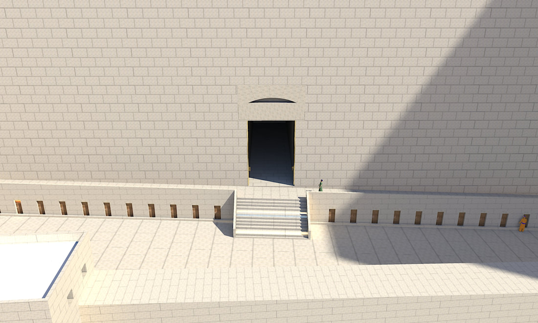
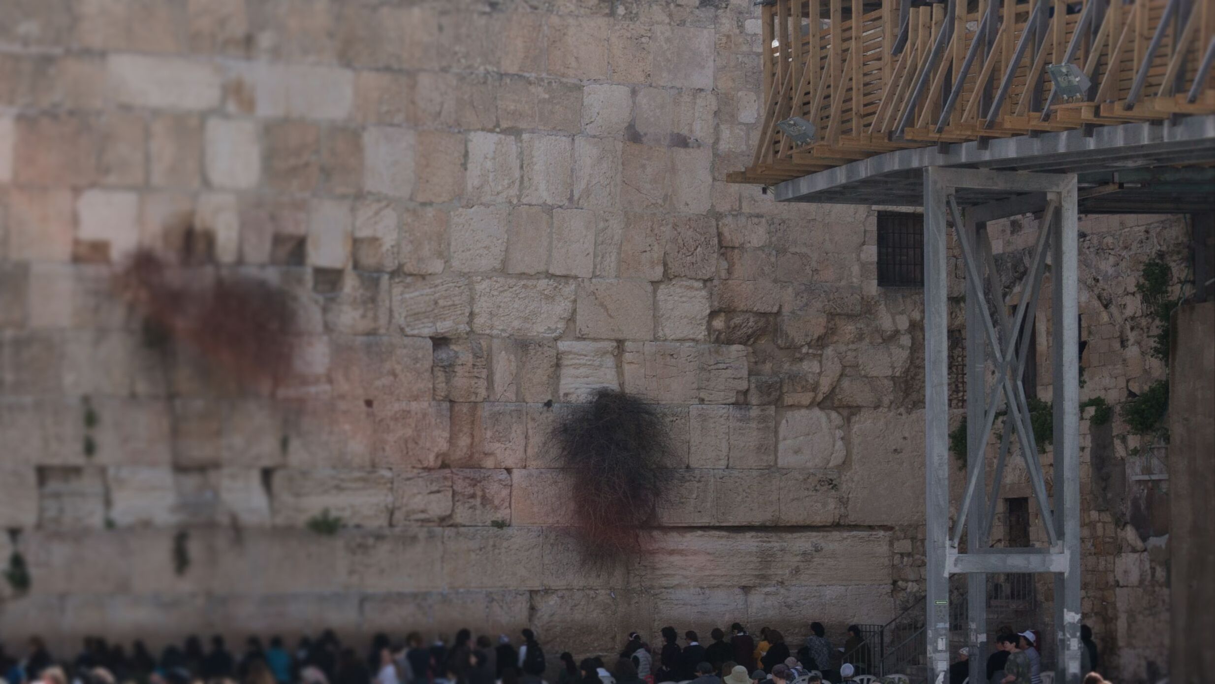
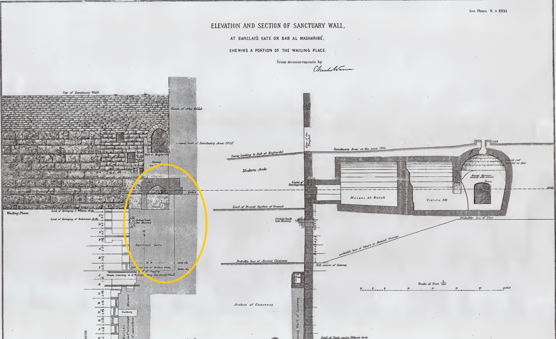
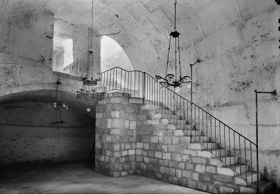
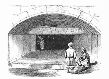
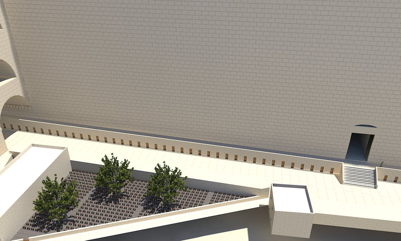
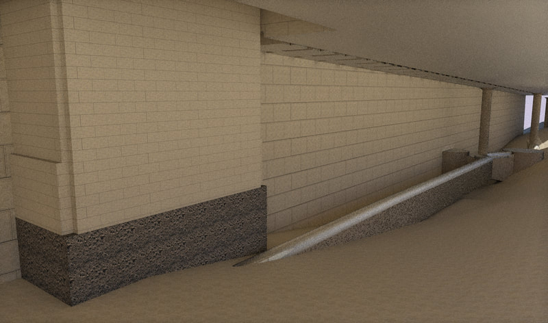
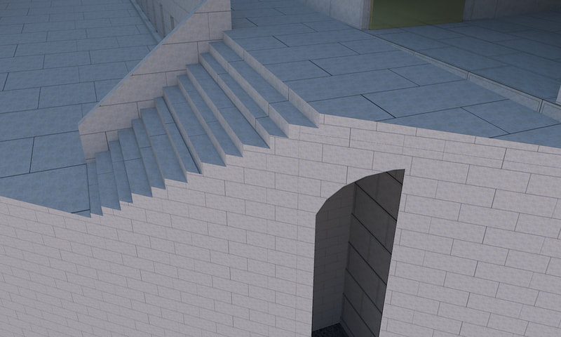
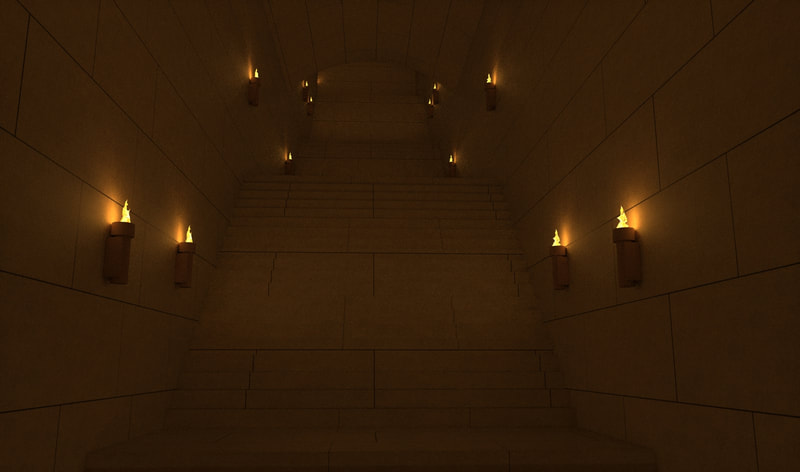
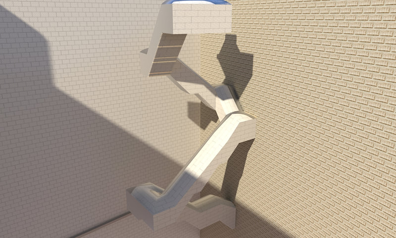
Around eighty meters (265 feet) away from the southern corner of the western wall, right by the southern end of the Ezras Nashim by the Kosel, a large lintel, with a blocked-up gate underneath, can be seen. The bottom of this lintel is 2398 ft. 5 in. (731 m) above sea-level. This seems to be the second of the gates which Josephus (Antiquities 15:11:5) says led to the suburbs of the city. (The gate that led over a passage to the king's palace was on top of Wilson's arch, and the road that descended to the valley by a great number of steps was the one on top of Robinson's arch, so the two suburban gates must be Warren's and Barclay's gates.) However, this statement seems slightly problematic, because it opens up straight into the city. R' Zalman Menachem Koren writes (the Beit HaMikdash, pp 146-147) that probably, there is a scribal error here, and that originally, Josephus wrote that two gates led to the Tyropoeon, (meaning that it led to the Tyropoeon valley,) and a copyist mistakenly changed it to "proesteon", which is Greek for suburbs. [You can also explain that since the road that went from in front of this gate went outside the first wall, to the area inside the second wall, (as shown here) therefore Josephus says that the gate led to the suburbs.] The lintel of this gate was first examined by a missionary, Dr. James T. Barclay, who wrote about it in his book (The city of the great king), printed in 1858, and the gate is therefore named after him. (The first written description of this gate was actually made by the Spanish traveler Domingo Badia y Leblich [in disguise as "Ali Bey el-Abbassi"] in 1807, who noted "the upper part of a magnificent portal, the superior portion of which consists of a single stone 20 feet long".) This gate, together with the passage behind it, was further examined by Wilson and Warren. The lintel is 6 ft 10 in (2.08 cm) tall, and the visible length is 20 feet (6.09 meters). Assuming that the lintel projects over the southern jamb as much as over the northern jamb, the total length is 24 ft 8 in (7.52 m). Currently, the lintel is not rectangular, rather the upper corners are rebated (the lower half projects on both sides of the upper half). However, other surviving Herodian lintel stones, (for example the ones on top of the double gates,) do not have this feature, rather they are rectangular. Dan Bahat (quoted in Gibson and Jacobsons' article about Barclay's gate) therefore suggests that also the lintel of Barclay's gate used to be rectangular, but it was later damaged in the upper corner. (The southern edge of this lintel is blocked, so we don't know how it looks.) Evidence for this is the fact that the Herodion margins are not visible in this corner. The gate itself is 18 feet (5.49 meters) wide, but its height is unclear. Warren found the stone course underneath the gate badly damaged, so he couldn't determine whether it was part of the gate opening, in which case the gate will be 32 ft 1 in (9.78 m) [nine stone courses] high, or whether it was broken at a later time, in which case it was only 28 ft 9 in (8.77 m) [eight stone courses] high. The smaller number is assumed (by Condor and Ritmeyer) to be correct. Under Barclay's gate, to the left, about eleven feet (3.35 m) lower than the bottom of the gate (using the lower estimate), Warren found "a heavy masonry wall, faced to north with well-dressed stones in courses 9 inches to 18 inches (22-45 cm) in height, without [marginal] drafts; it is perpendicular, and abuts on to the Sanctuary wall, and is a retaining wall, as it has only a rough face to south: it is 6 feet (1.82 meters) thick . It continues down for 35 ft 6 in (10.89 m), and its foundations are about 7 feet (2.13 meters) from the rock; they rest on rubbish" [Survey of Western Palestine, Jerusalem, page 190]. As mentioned in an earlier post, there was an elevated walkway running along the western Har Habayis wall, around three meters (10 ft) higher than the main street. Barclay's gate opened straight into this walkway, but it is logical that there was a staircase going up from the main street right in front of this gate. Ritmeyer supposes that these steps were supported by a vault underneath, and since Herodian vaults are many times closed up with walls at their two ends, the wall found by Warren was most probably one of the walls closing the vault. The Underground Passageway Behind this gate, a L-shaped passage leads up to the surface of the Har Habayis. This passage is cistern number 19, and it might have also included number twenty (using the commonly used numbering system. Using Schick system, it is number eleven, and maybe also ten). Behind the lintel of the gate, there is an arch, 10 ft (3.05 m) deep, 19 ft 3 in (5.86 m) wide, and 3 ft 8 in (1.12 m) high. The springing of the arch is on a level with the bottom of the lintel of the gate. Together, the thickness of this arch and the lintel is the same as the thickness of the Har Habayis wall. After this, there is a vaulted passage 18 ft (5.48 m) wide, and 55 ft (16.71 m) long. At this point, there is an 18 feet (5.48 m) square vestibule, covered by a flat dome. The passage then turns to the south and continues for another 43 ft (13.12 m). The vaulted roof of this part rises upwards towards the south with an angle of 1 in 10. based on this, it is assumed that while the western arm remained the same level, the southern arm rose up, either with a ramp or stairs. Although the walls of this passage are most probably Herodian, the vaulted roofs, (and the dome with its supports,) seems to be of later date (besides for the first arch, which based on its correspondence to the Har Habayis wall, seems to be original Herodian work). The western arm of the passage is currently divided into two parts by a thick wall, the western one unfortunately being a mosque, and the eastern one being a water cistern, with its walls coated with a thick layer of cement. Around 18.5 ft (5.6 m) to the south of this passage is another cistern, number 20 (or ten, using Schick's numbering system). This cistern is 40 ft (12.2 m) wide [from east to west], and 54 ft (16.5 m) long [from north to south]. It has a double vaulted pointed roof supported by a set of piers running up the center. It appears to be modern in construction, with the exception of the remains of an old arch on the western side. The floor of this cistern is 44.5 ft (13.56 m) below the present ground level above them, the ground level being around 2419 ft (737.3 m) above sea level. The western wall of this cistern is in line with the western wall of (the southern arm of) cistern 19, making it possible that the western part of this cistern is a continuation of the passage from Barclay's gate. Based on all this, it seems that in Herodian times, the passage led from Barclay's gate to the east, with the floor level staying the same, it then turned to the south, and started rising upwards, most probably with stairs. It continued going up past the southern limits of cistern 19, and into (what is now) cistern 20. It continued going up until it reached the Har Habayis surface, which (based on what the Radvaz writes in Teshuva 639) was much higher than the present level. (According to the calculations made in a previous post, it was around 174 ft [53 m] higher than it is now, reaching to a level of 2593 ft [790 m] above sea level.) Therefore, it probably had many turns, so it could reach the surface in the western part of the Har Habayis. reference
Conder, Claude Reignier, and Warren, Charles. The Survey of Western Palestine: Jerusalem. London, 1884. Gibson, Shimon and David Jacobson (1996), Below the Temple Mount in Jerusalem: A Sourcebook on the Cisterns, Subterranean Chambers and Conduits of the Haram Al-Sharif. Jacobson, David M., and Shimon Gibson. “The Original Form of Barclay's Gate.” Palestine Exploration Quarterly 129, no. 2 (1997): 138–49. doi:10.1179/PEQ.1997.129.2.138. Koren, Zalman Menachem. Beit HaMikdash: The Temple and the Holy Mount. United States: Shaar Press/ Mesorah Publications, in conjunction with the Western Wall Heritage Foundation, 2009. Ritmeyer, Leen. The Quest: Revealing the Temple Mount in Jerusalem. Israel: Carta, 2006. Wilson, Charles William, Warren, Charles. The Recovery of Jerusalem: A Narrative of Exploration and Discovery in the City and the Holy Land. United Kingdom: R. Bentley, 1871.
0 Comments
Leave a Reply. |
Website updatesI have added a new lego model of the Third Beis Hamikdash, with pictures and a video in the lego gallery. Categories
All
Archives
February 2024
AuthorMy name is Mendel Lewis. Hashem said to Yechezkel, "Its reading in the Torah is as great as its building. Go and say it to them, and they will occupy themselves to read the form of it in the Torah. And in reward for its reading, that they occupy themselves to read about it, I count it for them as if they were occupied with the building of it. (Tanchuma tzav 14) |
- Beis Hamikdash posts
-
sources
- Mishnayos Middos >
- Gemarah
- Rambam >
- Rishonim
- Sha'alos Uteshuvos HaRaDVaZ
- Shiltey Hagibborim
- Ma'aseh Choshev
- Chanukas Habayis (both) and biur Maharam Kazis on middos
- diagrams >
- Tavnis Heichal
- Be'er Hagolah
- Binyan Ariel
- Shevet Yehudah
- other
- Braisa D'Meleches Hamishkan
- Third Beis Hamikdash sefarim
- from Josephus-יוסיפון >
- קובץ מעלין בקדש
- Kuntres Klei Hamikdash
- Gallery
- videos
- 1st Beis Hamikdash
- 3rd Beis Hamikdash
- virtual walkthroughs
- 3d models
- Lego Gallery
- diagram of Mizbeach
- contact
Proudly powered by Weebly

 RSS Feed