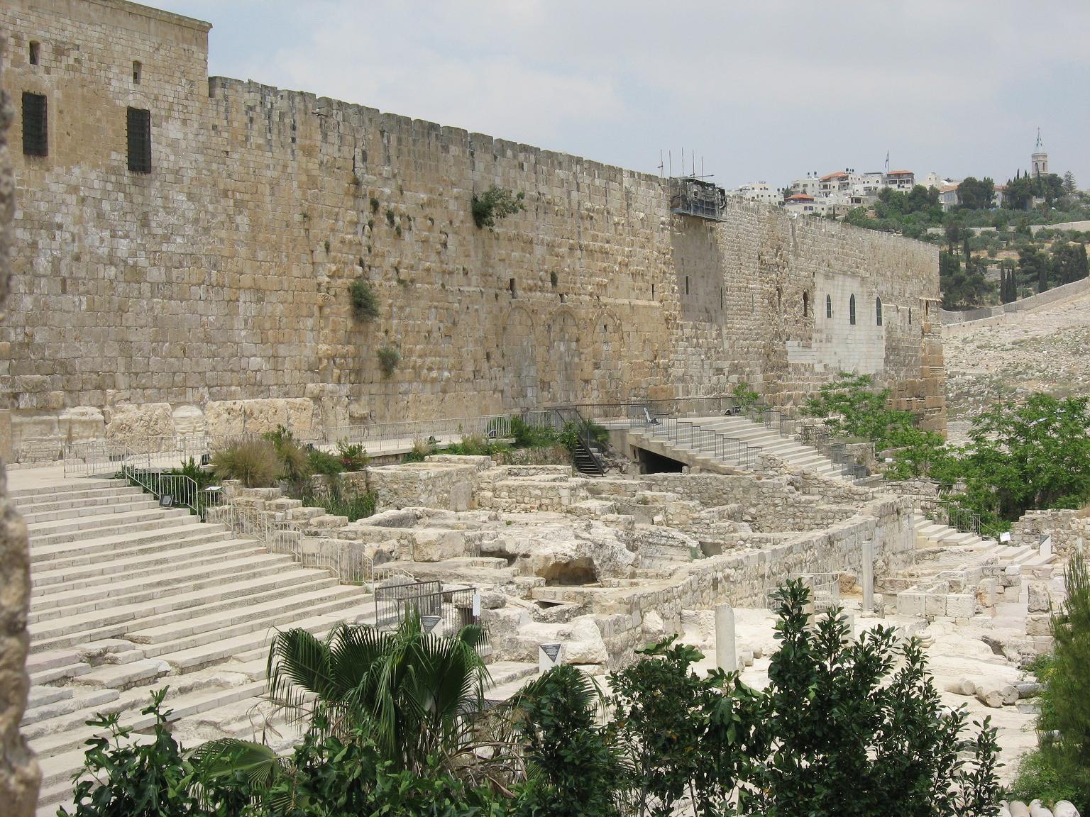
 The steps to the double gate, and the remains of the buildings east of it. (Photo credit: Oren Rozen, CC BY-SA 3.0 [https://creativecommons.org/licenses/by-sa/3.0], via Wikimedia Commons)
0 Comments
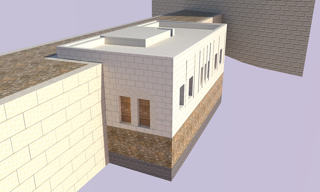
101 m (331 ft) east of the western edge of the southern wall is a double gate, almost the whole gate is still standing, besides for part of the easternmost doorpost. In front of this gate a tower was built during the crusader era, which covers up the western gate, and most of the eastern. (However, the gate itself was not sealed, and you can go from the tower through this gate.) The eastern gate was blocked up with small stones at the same time. This gate is sometimes called the (Western) Chuldah gates, although these are not the actual gates the Mishna (Middos 1:3) mentions, as those were in the wall of the square, 500 amah Har Habayis, and these are in the wall of Hurdus's expansion. (However, since these gates led to the real Chuldah gates, you can call them "Sharey Chuldah", and that might be why the Kaftor Vaferach [Perek Vov] calls them Sharey Chuldah.) However, this (and the triple gate) might be the gates Josephus refers to when he writes (Antiquities 15:11:5) that there were gates in the middle of the southern Har Habayis wall. 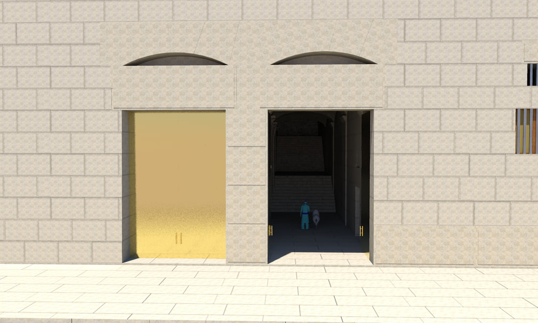 Running along the southern wall was a stepped walkway, 6.4 m (21 ft) wide, with stores built under it. In front of this was a large plaza, with steps leading to the two gates in this wall. 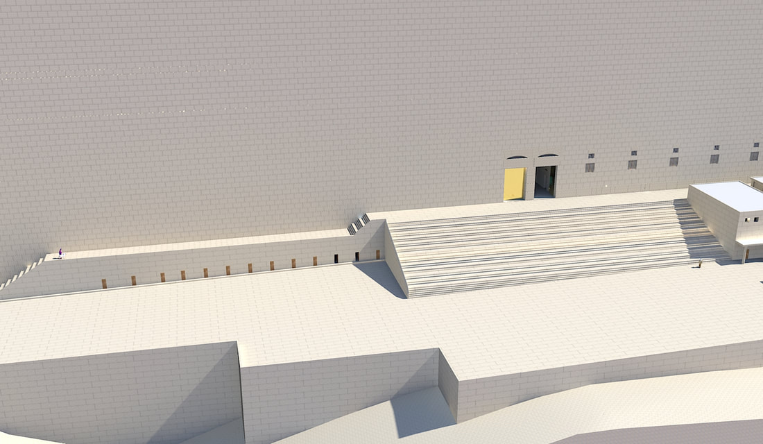 The southern wall of Hurdus's expansion of Har Habayis, is 281 m (922 ft) long. This wall is approximately at a ninety-degree angle to the Western Wall. This wall is entirely from Hurdus's time, as can be seen from the style of the stones. This wall extends from Nachal Kidron in the east, to the Tyropoeon valley in the west; the western part of the wall is actually built over the valley. In this wall are two gates, the double gate and the triple gate, which we will Imy"h discus in future posts. 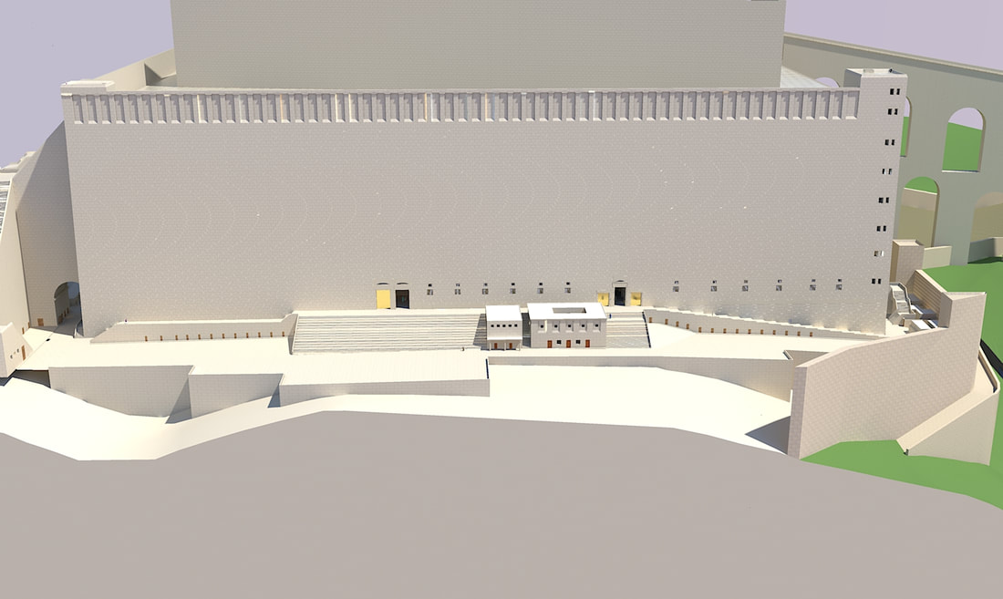 By the southwest corner of the Har Habayis, next to the gate above Robinson's arch, were chambers. On the roof of these chambers, a Kohen used to blow a trumpet every Friday, to signal that Shabbos is coming. During Binyamin Mazar's excavations, a stone was found, that mentioned this "Beis Hatekiah"-place of trumpeting. This corner is very suitable for this task, as it was high up, and faced the whole city, so it was easily heard. It was also right next to the main road of Yerushalayim, so everyone who was there knew it was time to close up shop and get ready for Shabbos. 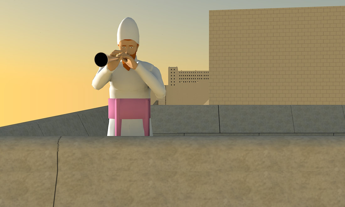 Running under the main street of Yerushalayim was a large drainage channel, partly cut into the rock. This channel went from the north of the city to the south, passing on the west of the Shiloach pool and exiting the city there. This drain was originally built at some point before Hurdus's time and was roofed with flat stone slabs. When Hurdus expanded the Har Habayis, the walls cut this drain, so a "by-pass” (with a vaulted roof) was made to connect the two severed sections of the drain. This "bypass" cut through several underground caves and cisterns in the area. A network of channels brought the water from the street and nearby buildings to this drainage channel. One paving stone by the western curb of the street, (right by the southwest corner of Har Habayis,) has five slots in it, for the water to go down to these channels, and from there to the main drainage channel. When the Romans destroyed Yerushalayim, some Yidden tried hiding in this drainage channel, but the romans searched for them and found them, and killed them. (Josephus, Wars 6:9:4 [6:429]).  In the previous post, I wrote about the monumental dining hall built during the Second MIkdash era. However, this building underwent significant changes at some point before the Churban 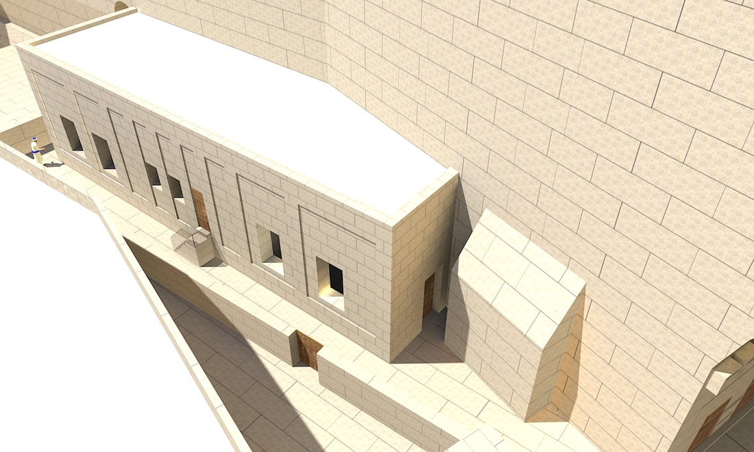 In the post about Wilson's arch, I have described a monumental building located next to it, called by Warren the Masonic Hall. After writing that post, I found more information about the hall, the thick wall next to it, and the Mikva'os behind the pier of Wilson's arch. In the next few posts, I will redescribe these places, based on this new information. 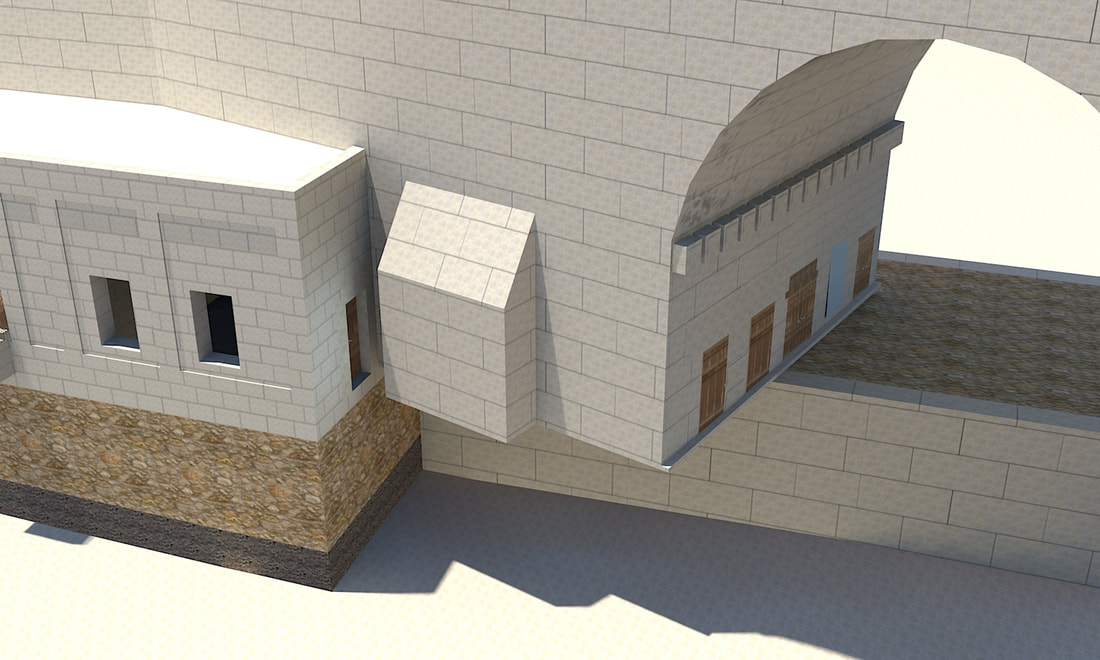 At the southern corner of the Western wall, remains of an arch can be seen. In the times of the Beis Hamikdash, this arch supported a grand staircase which led up to the Har Habayis. It is mentioned by Josephus (Antiquities 15:11:5), who writes: Now in the western quarters of the enclosure of the temple there were four gates; the first led to the king's palace, and went to a passage over the intermediate valley; two more led to the suburbs of the city; and the last led to the other part of the city, where the road descended down into the valley by a great number of steps, and thence up again by the ascent. 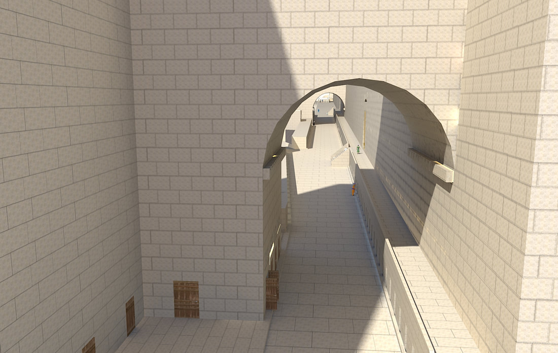 Around eighty meters (265 feet) away from the southern corner of the western wall, right by the southern end of the Ezras Nashim by the Kosel, a large lintel, with a blocked-up gate underneath, can be seen. The bottom of this lintel is 2398 ft. 5 in. (731 m) above sea-level. This seems to be the second of the gates which Josephus (Antiquities 15:11:5) says led to the suburbs of the city. (The gate that led over a passage to the king's palace was on top of Wilson's arch, and the road that descended to the valley by a great number of steps was the one on top of Robinson's arch, so the two suburban gates must be Warren's and Barclay's gates.) However, this statement seems slightly problematic, because it opens up straight into the city. R' Zalman Menachem Koren writes (the Beit HaMikdash, pp 146-147) that probably, there is a scribal error here, and that originally, Josephus wrote that two gates led to the Tyropoeon, (meaning that it led to the Tyropoeon valley,) and a copyist mistakenly changed it to "proesteon", which is Greek for suburbs. [You can also explain that since the road that went from in front of this gate went outside the first wall, to the area inside the second wall, (as shown here) therefore Josephus says that the gate led to the suburbs.] 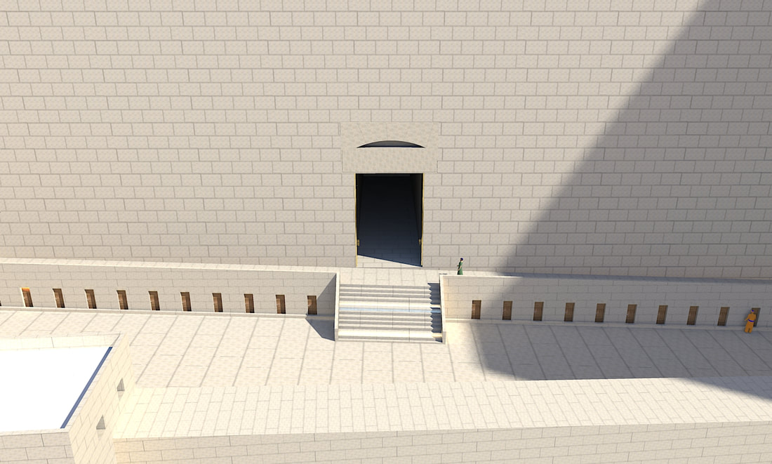 Around thirty meters to the south of Wilson's arch is the Kosel Plaza, where we daven. This section is 58 meters long. In a previous post I have theorized that the reason we daven specifically here is because the inner part of this wall is from Shlomo Hamelech's Har Habayis. (There are various sources (אלה מסעי עמוד ה-ו, מסעות א"י ע' 147, ליקוטים הביאו הב"ח או"ח סי' תקס"א) that say that the Kosel is from Shlomo Hamelech's times, and its foundations were built by Dovid Hamelech. However, this raises a question, because in the east wall of the Har Habayis we see stones from that time, and they are a different style, they are less smooth. Also, we do not see a seam in the western wall, where the original wall and Hurdus's wall would've met, like we see in the eastern wall. However, if we say that the outer stones that we see are actually Herodian, but there are more stones behind from the time of the first Beis Hamikdash, these questions get answered. 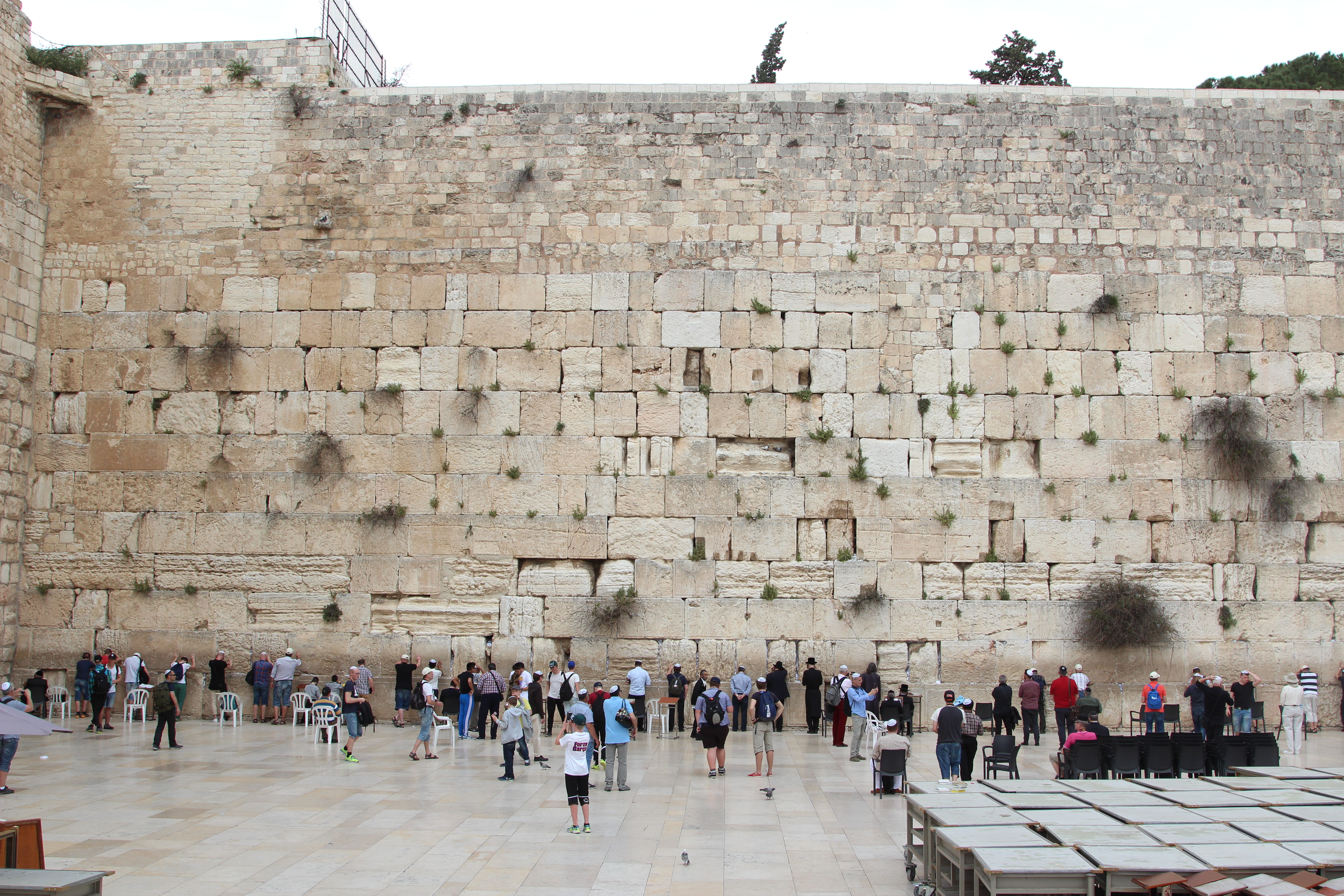 Fallaner, CC BY-SA 4.0 Approximately 600 feet (180 meters) to the north of the southern corner of the western wall there is an arch. This arch is 14.65 meters (48 feet) wide and has a span of 12.80 meters (42 feet). Its crown reaches a height of 21 feet (6.43 meters). The arch springs out of the western wall at a level of 2391.5 feet (728.9 meters) above sea level. The arch is made out of 23 rows of stone. On top of this arch are two gates to the temple mount, the gate of the chain (Bab as-Silsileh) and the gate of the Shechinah (Bab as-Sakina). This is the first of a series of arches supporting a road leading from the city to the Har Habayis. This arch was first discovered in the 1850s by Titus Tobler, a Swiss-German explorer of Yerushalayim. It was further explored by Charles Wilson and is therefore called Wilson's arch. 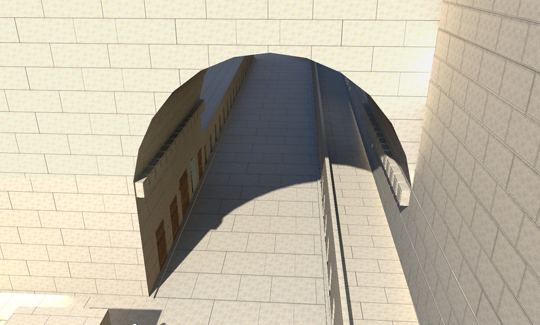 The main archeological explorations of the Har Habayis were between the years 1850-1900. Since after the six-day war, excavations were made outside the walls, but no excavations were done inside the walls, and the main information we have about it comes from these early archeologists. In this post, I will give some details about some of these archeologists.
Three-hundred and fifty-five meters to the north of the southern corner of the western wall, there is a gate going through a tunnel into Har Habayis, called now Warren's gate. This gate is mentioned by Josephus, who says (Antiquities 15:11:5): Now in the western quarters of the enclosure of the temple there were four gates; the first led to the king's palace, and went to a passage over the intermediate valley; two more led to the suburbs of the city; and the last led to the other city, where the road descended down into the valley by a great number of steps, and thence up again by the ascent". This is one of the gates which led to the suburbs, as it was located outside the original walls of Yerushalayim, in the area inside the second wall. 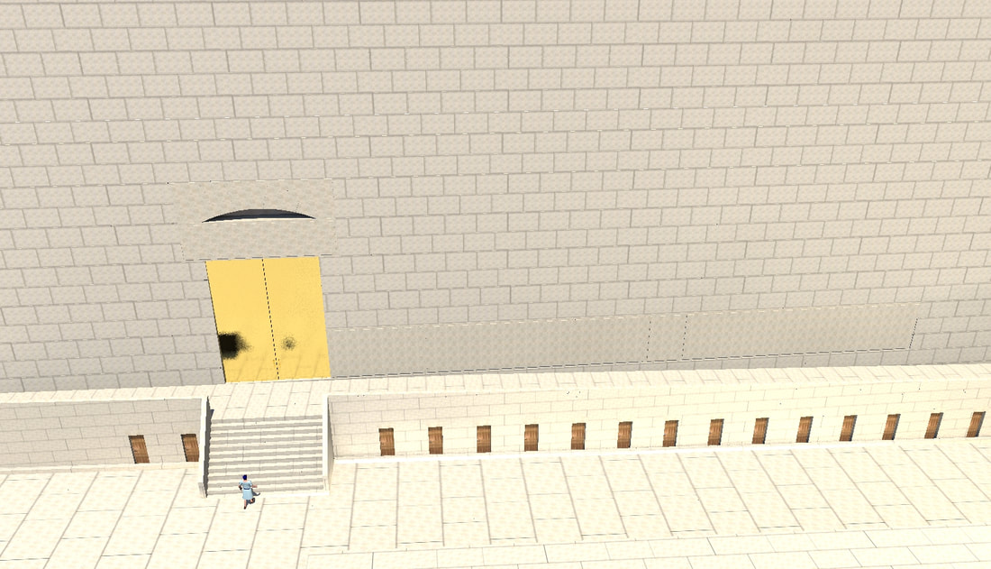 The northernmost 79 meters of this wall are not in the same line as the rest of the wall, but projects around 2.5 meters outwards. Although you can say that was because of a tower that was there, this does not seem to be the case, being that this projection is 79 meters wide, way too wide for a tower. 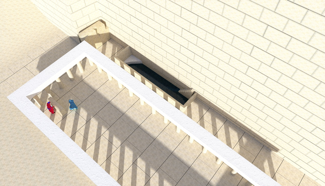 The western wall of Hurdus's expansion of Har Habayis, is 485 meters long. This wall, as mentioned in an earlier post, is not perfectly aligned with the north-south-east-west axis, rather it is on a ten-degree angle from it. It had four gates (Josephus, antiquities 15:11:5), two of which led through tunnels to the top of Har Habayis, and the other two opened on top, straight into the plaza of Har Habayis. The northern lower gate is now called Warren's gate, and the southern one is called Barclay's gate. The two upper ones were on top of what is now called Wilson's arch and Robinson's arch. I will IMY"H discuss these gates in future posts. 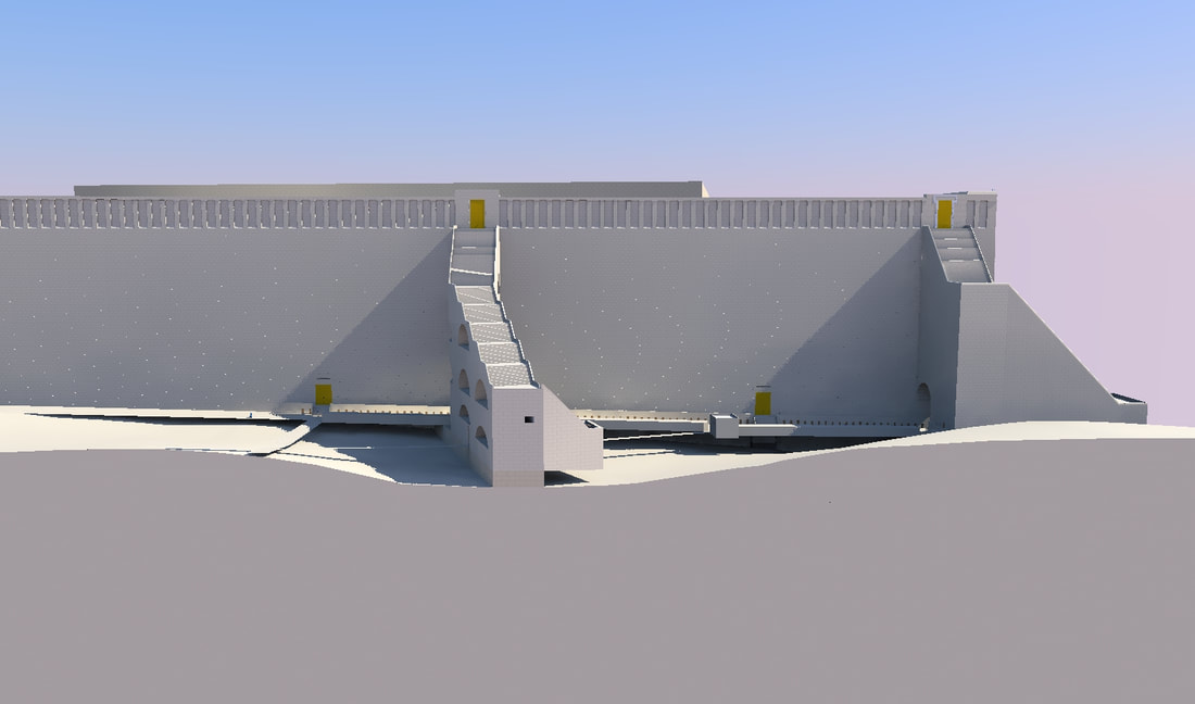 In the present-day walls of Har Habayis, there are two types of stones from the time of the Beis Hamikdash, one from the time of the first Beis Hamikdash, and one from the times of Hurdus. The stones are mostly between three and four feet tall (approximately one meter), and around five feet (1.5 meters) thick, but their length has no standard size, with some stones being very short and some being very long.
Each course of stones is set back a little from the course under it. This was done to strengthen the wall, since these walls were very tall, up to 100 meters, and had to withstand the pressure of the dirt fill of the Har Habayis. These setbacks are generally between one and a half and two and a half inches (three to six centimeters), while in the east wall, since the wall was taller, (because it started on a lower level,) they are between three and four inches (7 to 10 cm), and in one course, the setback is six inches (15 cm). The Gemara in Zevachim (54a), when discussing that there was no yesod on the south and east sides of the Mizbeach, asks a question. If there was no yesod under part of the Mizbeach, how could a bird Olah be offered there? The bird Olah's blood must be sprinkled on the upper half of the mizbeach, and it was preferably offered on the southeast corner of the Mizbeach, but since there is no yesod, the blood is just going to go on the floor? The Gemara answers, that there was a piece sticking out of the Mizbeach in that corner, for the blood to go on. (This is how Rashi explains the Gemara. Rabbeinu Tam explains it differently.) Based on this Gemara, I have added this Piece to the Mizbeach. 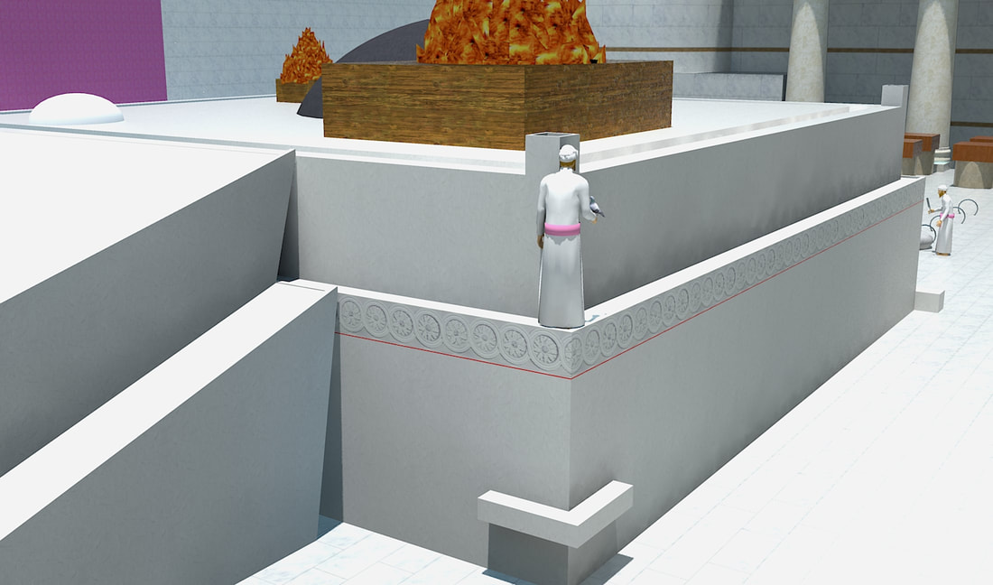 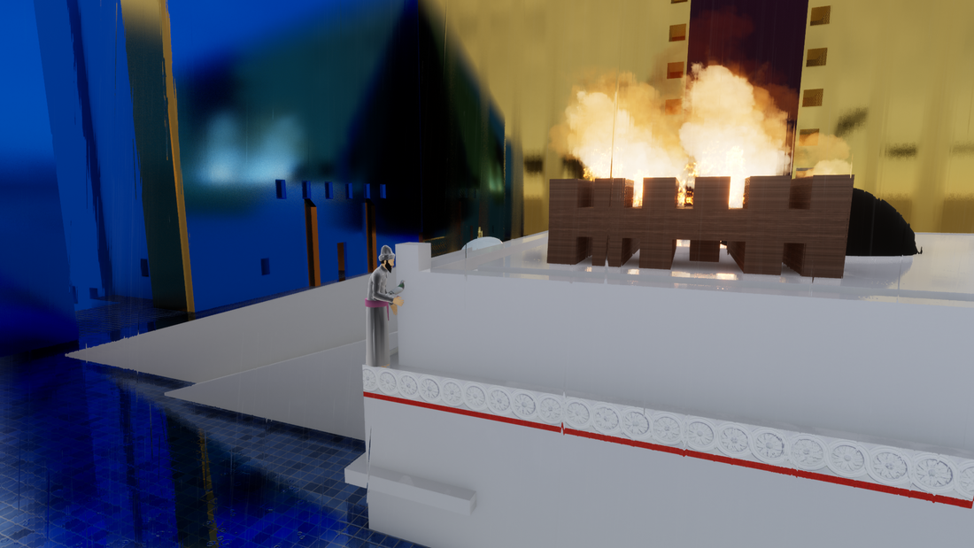 |
Website updatesI have added a new lego model of the Third Beis Hamikdash, with pictures and a video in the lego gallery. Categories
All
Archives
February 2024
AuthorMy name is Mendel Lewis. Hashem said to Yechezkel, "Its reading in the Torah is as great as its building. Go and say it to them, and they will occupy themselves to read the form of it in the Torah. And in reward for its reading, that they occupy themselves to read about it, I count it for them as if they were occupied with the building of it. (Tanchuma tzav 14) |
- Beis Hamikdash posts
-
sources
- Mishnayos Middos >
- Gemarah
- Rambam >
- Rishonim
- Sha'alos Uteshuvos HaRaDVaZ
- Shiltey Hagibborim
- Ma'aseh Choshev
- Chanukas Habayis (both) and biur Maharam Kazis on middos
- diagrams >
- Tavnis Heichal
- Be'er Hagolah
- Binyan Ariel
- Shevet Yehudah
- other
- Braisa D'Meleches Hamishkan
- Third Beis Hamikdash sefarim
- from Josephus-יוסיפון >
- קובץ מעלין בקדש
- Kuntres Klei Hamikdash
- Gallery
- videos
- 1st Beis Hamikdash
- 3rd Beis Hamikdash
- virtual walkthroughs
- 3d models
- Lego Gallery
- diagram of Mizbeach
- contact
 RSS Feed
Proudly powered by Weebly